

Corporate Profile
 Ocean Imaging was founded in 1984, initially specializing in satellite-derived ocean temperature analyses for fishing fleets and derivation of ocean current and ice drift trajectories for the offshore oil industry. Subsequent projects with the National Marine Fisheries Service and several universities targeted better utilization of satellite technologies for fisheries and coastal resource management.
During the1990's we expanded our ocean monitoring services, broadened grant-funded research activities and developed our own multispectral aerial sensors for coastal and terrestrial mapping.
Today, Ocean Imaging is recognized as one of the world's leaders in innovative utilization of remote sensing techniques for oceanic and coastal applications.
Learn More →
Ocean Imaging News/Publications
2025:
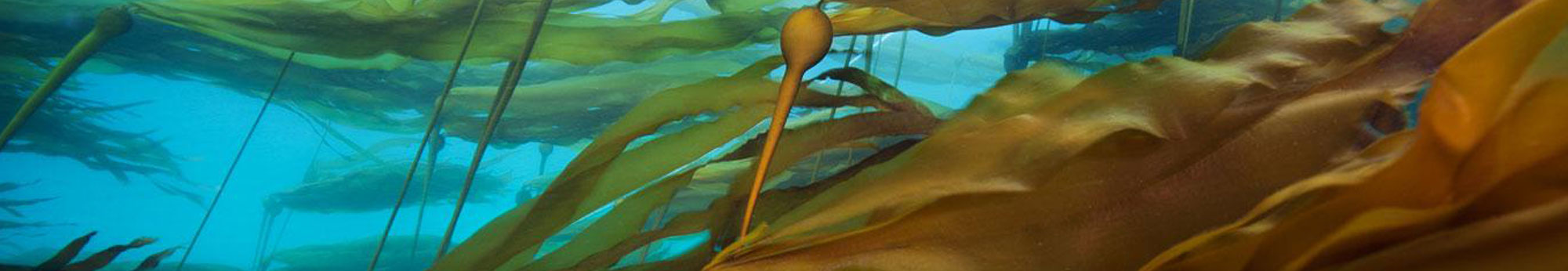
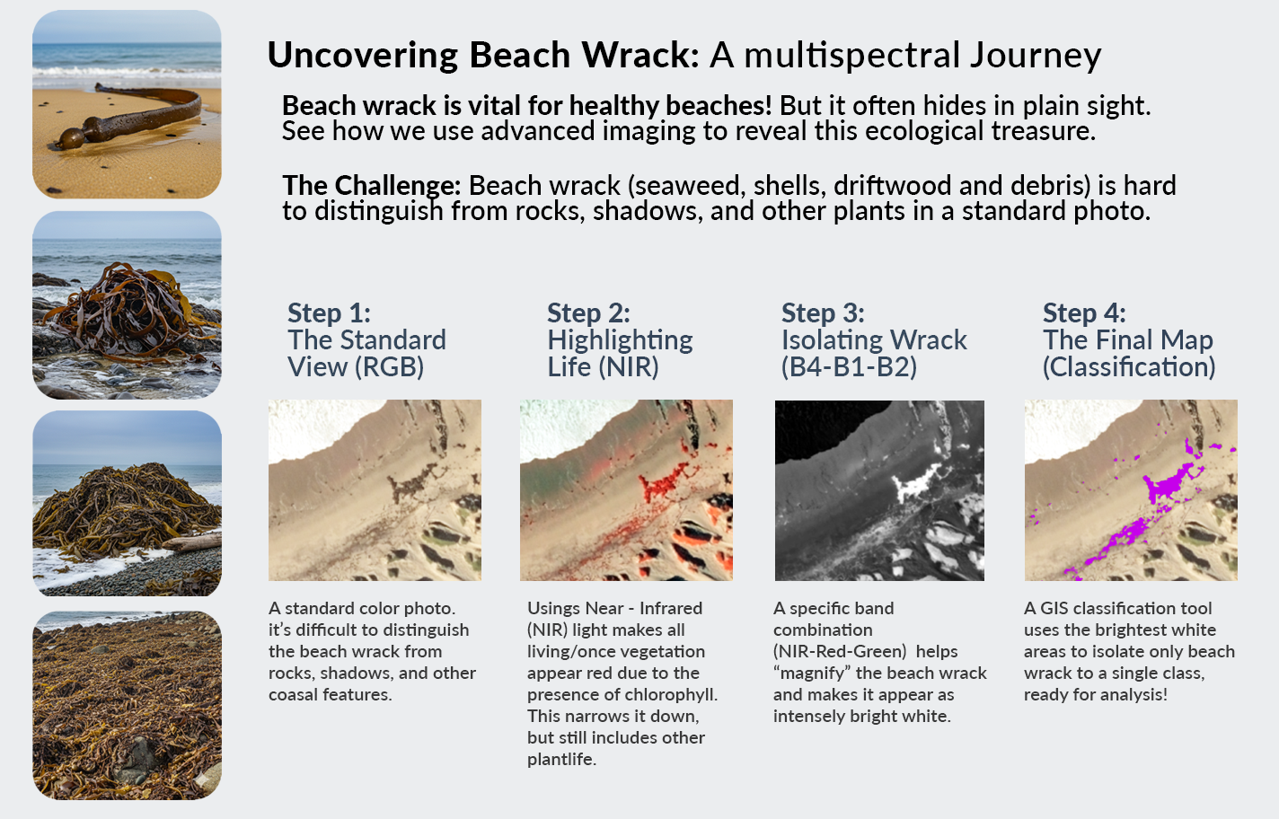 Ocean Imaging has been mapping Giant Kelp surrounding San Nicolas Island off the coast of California for over 15 years. Last year we began a multi-year project to not only map kelp, but also the beach wrack covering the island’s sandy beaches and rocky shoreline.
.jpg) Ocean Imaging's latest peer-reviewed scientific paper on the existing unavailability of natural drinking water sites as a prime factor driving the domestication of Key deer.
Ocean Imaging's latest peer-reviewed scientific paper on the existing unavailability of natural drinking water sites as a prime factor driving the domestication of Key deer.
2024:
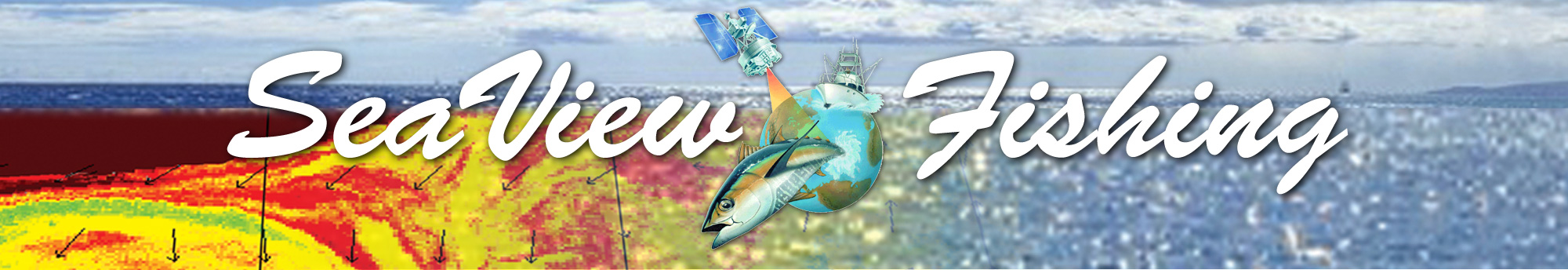
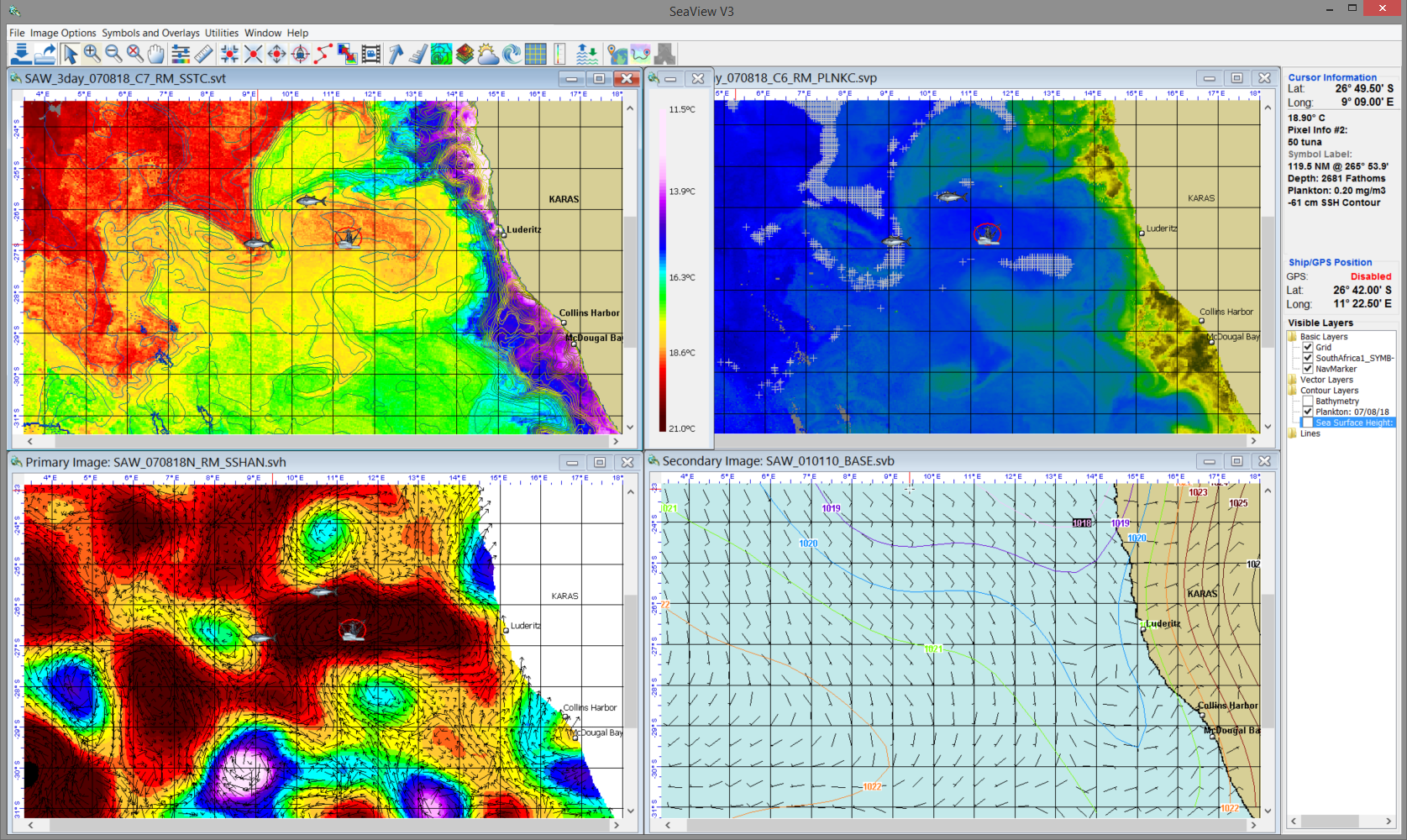
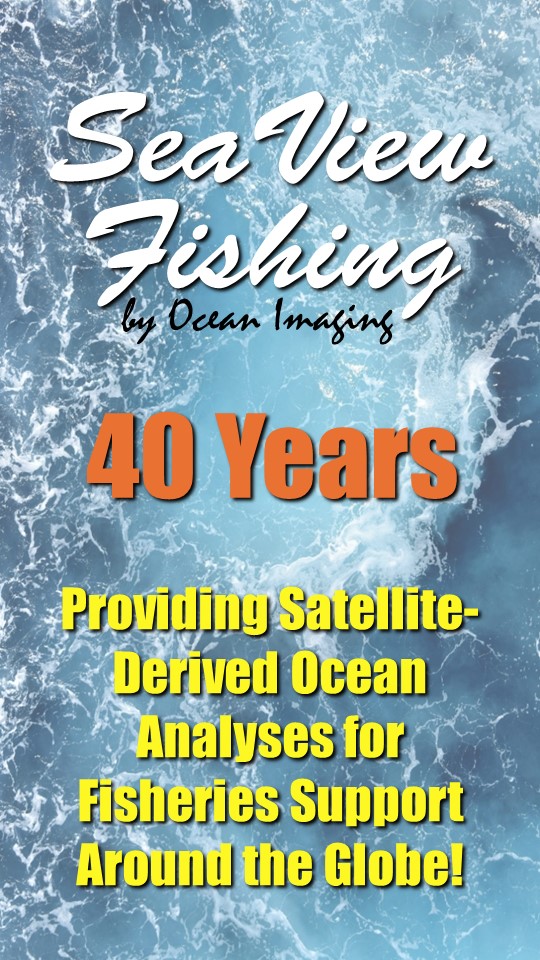 Ocean Imaging & SeaView Fishing Celebrate 40 Years of Providing Satellite-Derived Ocean Analyses for Fisheries Support
July 2023:
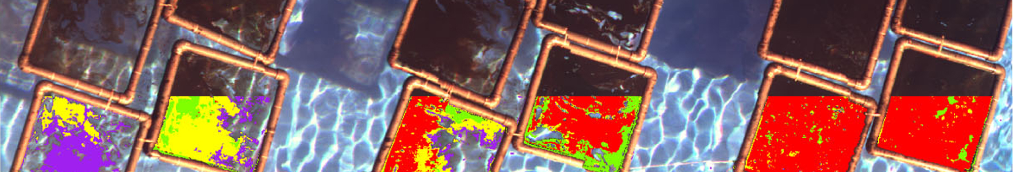
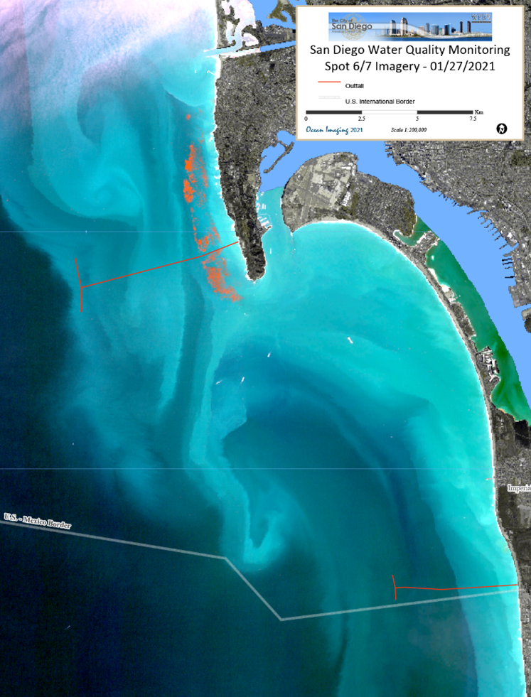 Ocean Imaging Renews Long-Term Contract with the City of San Diego to Help Monitor Coastal Water Quality
April 2023:
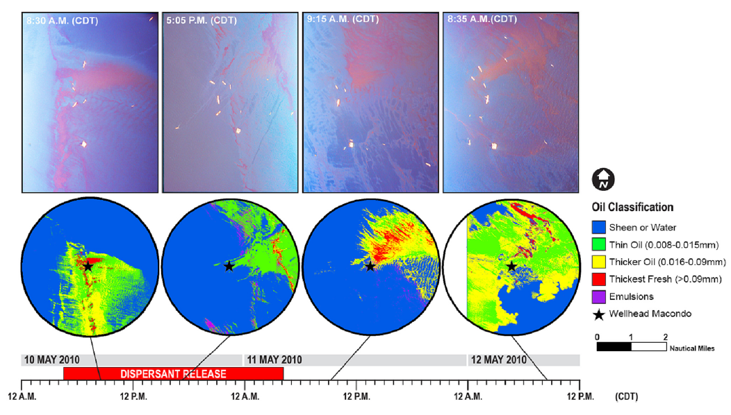 Ocean Imaging's latest peer-reviewed scientific paper on the use of remote sensing to study the effects of sub-sea dispersants during the Deepwater Horizon oil spill
2022-2023:
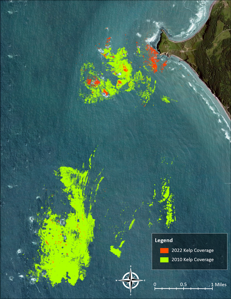 Ocean Imaging Works with Oregon Department of Fish and Wildlife to Map Coastal Kelp Beds
March 2023:
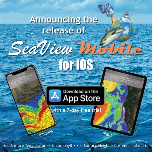 SeaView Fishing Mobile app now available for Apple Mobile Devices
NOVEMBER 2021:
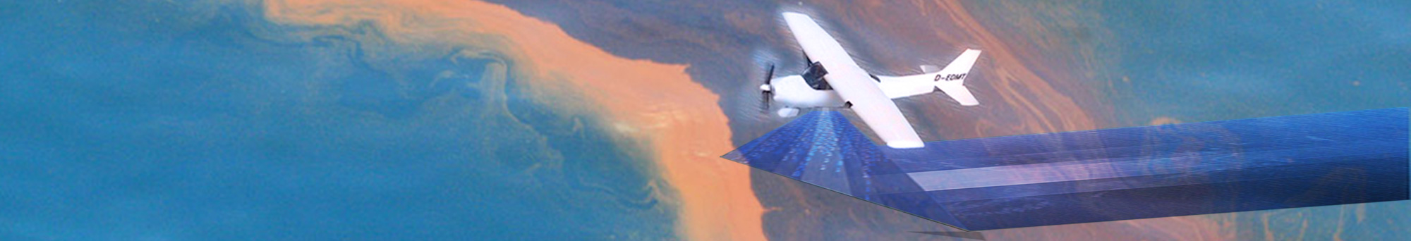
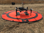
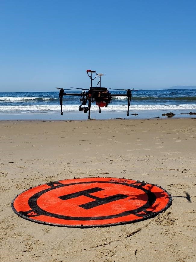 Ocean Imaging completes study to improve oil detection capability using a portable, UAS-Based SCAT Reconnaissance System
october 2021:
 Ocean Imaging rolls out SeaView Mobile app
JUNE 2021:
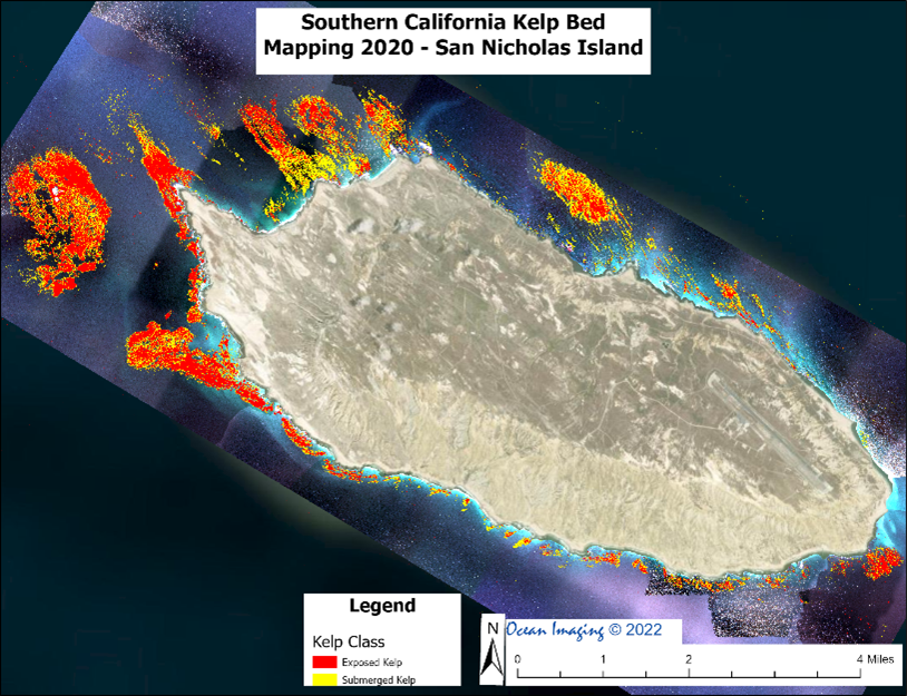 Ocean Imaging completes latest round of projects to Map Kelp off the California coast
JUNE 2020:
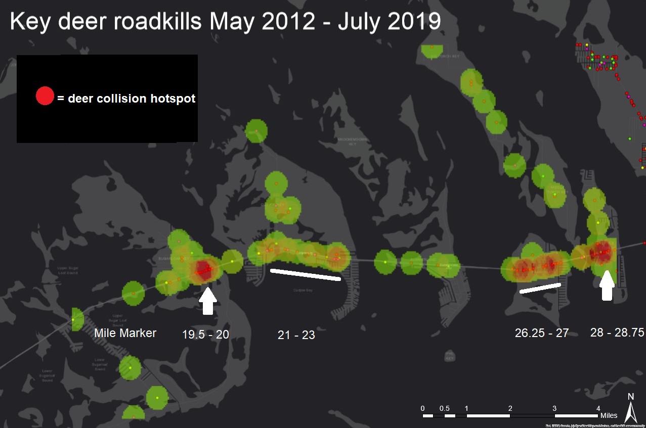 Ocean Imaging conducts GIS study of vehicle-caused Key deer deaths in the Florida Keys
January 2020:
 Ocean Imaging publishes peer-reviewed results of post-hurricane Irma study in the Florida Keys
January 2019:
 Ocean Imaging Receives Funding to Improve Oil Detection Capability Using a Portable, UAS-Based SCAT Reconnaissance System
December 2018:
 Ocean Imaging Celebrates 35 Years of "Finding Fish from Space"

December 2018:
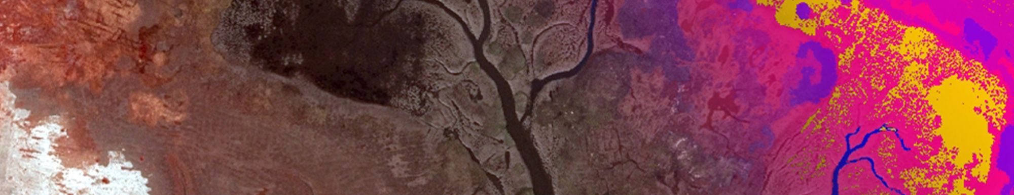
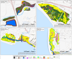 Ocean Imaging Marks 15 Years of an Environmental Monitoring Project to Help Restore California's Wetlands
27 November 2018:
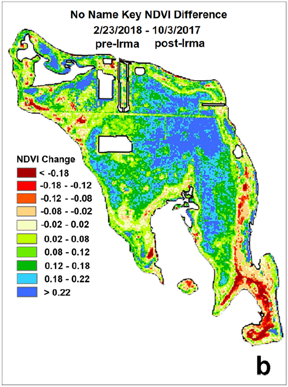
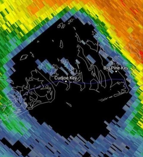 Ocean Imaging Completes Study of Vegetation Response to Hurricane Irma in the Florida Keys
April 2018:
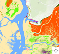 Ocean Imaging Continues 15 Years of Work to Map Eel Grass in Morro Bay, California