Oil Spill Response and Research
 Real-Time Oil Distribution, Quantity & Trajectory Mapping
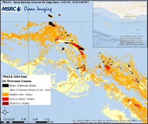
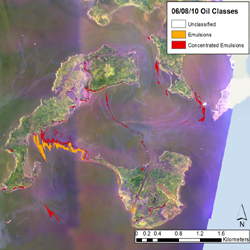
Since 2004, Ocean Imaging has worked under federal and State of California funding to develop hardware and software capabilities for mapping oil spills in real-time and immediately disseminating COP-ready map products to the various response groups. The GIS-compatible digital maps show oil location and distributions patterns, oil film thickness, and oil weathering state. Over the past several years the developed capabilities have been utilized during actual oil spills in California and were heavily depended on during the 2010 Deepwater Horizon (DWH) spill in the Gulf of Mexico, where Ocean Imaging flew multiple daily missions for 3 months. Since the DWH spill, OI has been directly involved in numerous drills, training exercises and research project to both perfect the characterization of the different states of oil on water as well as improve our real-time data dissemination system to response vessels and near-real time information product delivery to COPs.
 Oil Recovery & Response Resource Allocation Support
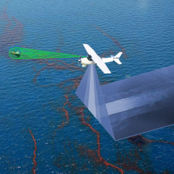
Ocean Imaging’s aerial mapping of oil distribution and thickness provides response managers vital information on where resources such as skimmers and booms can be utilized most urgently and effectively. During the Deepwater Horizon spill, digital maps showing the exact locations of recoverable oil accumulations were streamed directly to vessels at-sea in near-real-time. Now in cooperation with the Marine Spill Response Corporation (MSRC) we have tested in fully implemented an aircraft to ground (or boat) real-time data transfer system through which imagery of actionable oil can be transmitted directly to response vessels and/or an Incident Command Post (ICP) within a few minutes of data acquisition.
 Land-Based Oil & Chemical Spill Mapping
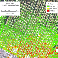
Ocean Imaging’s spill mapping technology is not limited to at-sea spills. We have also mapped oil spills on land, including a well blow-out, weather-related inland spills and chemical spills caused by liquid materials exploding into the air.
 SCAT and NRDA Field Team Support
Ocean Imaging’s aerial and now UAS systems, specially configured for oil detection, provide very high-resolution mapping of oil-impacted shoreline and marshland areas. Such analyses provide SCAT and NRDA field teams with oil distribution information before they set out into the field, helping them plan their missions more efficiently. During the Deepwater Horizon spill which affected large portions of the Mississippi Delta wetlands, Ocean Imaging’s maps provided field crews with knowledge of where and how far oil has penetrated in areas difficult to reach by boat or on foot. OI is presently involved in research to outfit sUAS platforms with specialized sensors and data acquisition and dissemination software to help SCAT and NRDA teams quickly identify crude oil and other spilled petroleum products in intertidal, wetland and difficult to reach inland environments.

 Oil Spill Response: Classification example
 Oil Spill Recovery:
