
Grant Funded Research & Development
Since its inception, Ocean Imaging has been very active in scientific research. Unlike many other remote sensing and GIS companies that only provide commercial data and services, we routinely receive research grants from federal, state and corporate agencies. Our sponsors have included the National Science Foundation, NASA, NOAA, the Navy, Bureau of Safety and Environmental Enforcement, EPA, the California Coastal Commission, the American Fisherman’s Research Foundation, AYKSSA, Oregon and California Fish and Wildlife agencies, and large corporations. We also routinely collaborate on grant funded research with academic institutions.
In many cases, the research activities target the development of new remote sensing applications or the use of novel remote sensing techniques to study particular events of interest. These studies evolve, in turn, to long-term, operational monitoring projects. We welcome collaborative research opportunities which combine our remote sensing resources and expertise with the expertise of other scientists and specialists to help advance physical, biological or ecological knowledge. For a sample of peer-reviewed publications and scientific articles that resulted from this work click here.
Sample Past Research Activities
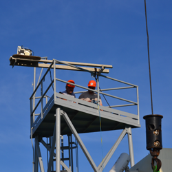
2019 - Ocean imaging Receives Funding to Improve Oil Detection Capability Using a Portable, UAS-based SCAT Reconnaissance System
Shoreline Cleanup Assessment Technique (SCAT) operations are a fundamental part of oil spill response for both marine and inland spills. The project funded by California Department of Fish and Wildlife (CDFW) Oil Spill Prevention and Response (OSPR) division aims to incorporate sophisticated sensors/cameras into a portable and water-resistant sUAS, so that responders and SCAT teams can more quickly and accurately identify and assess oiled areas in shoreline and inland waterway habitats. The project also aims to build upon and expand results of OSPR's initial efforts by enhancing OSPR's present imaging system's accuracy of separating true oiled areas from false targets through the addition of a specially configured cameras. The project team will also conduct additional experiments for algorithm development not only with artificially created oil targets but with actual, naturally formed oiled shoreline targets originating from natural oil seeps in California.
2015-2017 - NOAA Partners with OI to Advance Oil Spill Remote Sensing
In the effort to continue building upon remote sensing utilization experiences gained during the Deepwater Horizon oil spill in 2010, NOAA is leading a multi-entity project to enhance future capabilities to map weathered oil and oil emulsions in future spills. The project was funded by the Bureau of Safety and Environmental Enforcement (BSEE) and includes several novel advancements in oil spill mapping technology. More →
2013 - OI’s Jan Svejkovsky Wins Multiple Awards for Scientific Paper
Ocean Imaging’s President – Dr. Jan Svejkovsky – is the primary author on a peer-reviewed paper published in the October, 2012 issue of the journal Photogrammetric Engineering & Remote Sensing(PE&RS): “Operational Utilization of Aerial Multispectral Remote Sensing during Oil Spill Response: Lessons Learned During the Deepwater Horizon (MC-252) Spill,” PE&RS, 78(10): 1089-1102. The paper details OI’s aerial oil spill mapping system and its multiple uses during the massive 2010 Deepwater Horizon oil spill. Early in 2013, the American Society for Photogrammetry and Remote Sensing (ASPRS) chose Svejkovsky et al.’s paper to receive two annual awards for its content and quality: the Boeing Award for Best Paper of the Year, and the John I. Davidson President’s Award (3rd place) for Best Practical Paper. Both awards include a cash prize and were presented on 26th March, 2013 at ASPRS’ Annual Conference in Baltimore, Maryland. While Svejkovsky was not able to attend the ceremony, the awards were received on his behalf by Joseph Mullin – one of his co-authors and an ardent supporter of the OI oil mapping system’s development during his pre-retirement tenure at the US Minerals Management Service.
2010 - 2014 - OI Awarded SeaGrant Funds to Map Marine Protected Areas (MPAs)
California Sea Grant awarded OI a 3-year grant and then another 2-year grant to generate a high-resolution baseline data base of natural resources in estuarine, intertidal and shallow subtidal areas related to the newly created Marine Protected Areas (MPAs) in North-Central and Southern California. The project also included annual mapping of kelp beds over the entire region and persistence analyses aimed to establish the pre-MPA variability in kelp and estuarine resources using time series of historical and recently collected data. "We are very excited to become part of the MPA-related studies", said OI's president, Dr. Jan Svejkovsky. "We will be collaborating with numerous academic research teams who will get access to our aerial remote sensing technologies through this program."
Aug 2009 - Satellite-derived Multivariate Data Base for Evaluating Environmental Influence on AYK Salmon
This federally and state funded research project focused on determining if environmental change in the Bering Sea has played a role in the drastic drop of several species of salmon along the Sea's Alaska shores in the late 90s.
Development of Rapid Biomass Assessment Technology for Alaska's Kelp Industry
This NASA-funded project aimed to develop remote-sensing based large area kelp biomass mapping capabilities. Annual assessments can then be used to establish kelp harvesting quotas for developing harvesting businesses servicing food additive and agrochemical companies.