Geospatial environment Analysis
Geospatial Data Integration
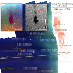
Ocean Imaging has decades of experience in selection and integration of the right remote sensing and GIS datasets necessary for a particular application or research study. We understand the strengths of the wide selection of satellite, aerial and UAS platforms and sensors and how they can fit together with vector and field data for specific purposes. Whether it be emergency response or environmental mapping and monitoring, we have worked with almost every remote sensing datatype to find answers and solutions for our clients.
 GIS Services
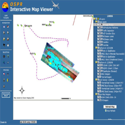
GIS technologies are utilized in virtually all of Ocean Imaging's projects. We also provide GIS development support ranging from development of self-contained GIS systems and databases customized for particular applications, to the compilation of various archived and contemporary data sources and their digitization, visualization and analysis. OI has developed Web Map Servers for such clients as the Oil Spill Prevention and Response division of the California Department of Fish and Wildlife. We support an ArcGIS Server platform in a fully secure, climate-controlled facility which we have tested with several online mapping sites and Common Operating Picture servers such as NOAA’s Environmental Response Management Application (ERMA) and The Response Group’s (TRG) COP.
 Change Detection
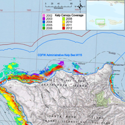
Many of Ocean Imaging’s operational and research projects utilize customized techniques to detect changes over time through multiple image data sets. OI's expertise spans from using several satellite images collected over a single or more days to detect changes in ocean current and plankton patterns, to analysis of changes in regional vegetation over periods of decades. OI has also utilized our aerial sensors to help assess changes in ground cover and plant health as the result of oil and chemical spills. Typically, we image the affected area and a nearby unaffected “control” area with the same ecological characteristics, and re-image both areas several weeks later. Statistical analysis of changes in such parameters as Normalized Difference Vegetation Index (NDVI) derived from the image pairs are then used to assess natural temporal changes affecting the control area versus any abnormalities in vegetation affected by the spill. OI has also been part of multi-year kelp bed change analysis studies as well as post hurricane assessment of coastal vegetation in the Florida Keys.
 Thermal Discharge Tracking
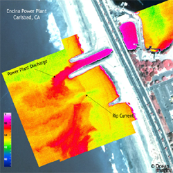
Ocean Imaging's thermal IR aerial system allows us to discern differences in soil or water temperature as small as 0.08°C. OI has utilized the imagery to track warm water discharges from powerplants into the ocean, and even mapped potential areas of groundwater seepage on land.
 Environmental Impact Assessments
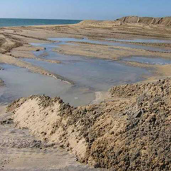
Ocean Imaging has provided EIAs both independently and as partners with other experts. These include both terrestrial and ocean areas of interest. One example of an ocean-related EIA was the evaluation of potential effects of a rock jetty extension on nearby surf grass beds. Aerial multispectral imaging was used to map the beds and existing sand distributions, and those data were, in turn, used as inputs to a sand redistribution model for the jetty extension.
Services and Capabilities
Fisheries Support Services
Natural Resource Mapping and Monitoring
Oil Spill Response and Research
Geospatial Environmental Analysis >>
Resource Management and Litigation Support


