
PROJECT: |
State of California, Dept. of Fish & Game, Oil Spill Response Division |
LOCATION: |
California Coast |
DATE: |
2008 |
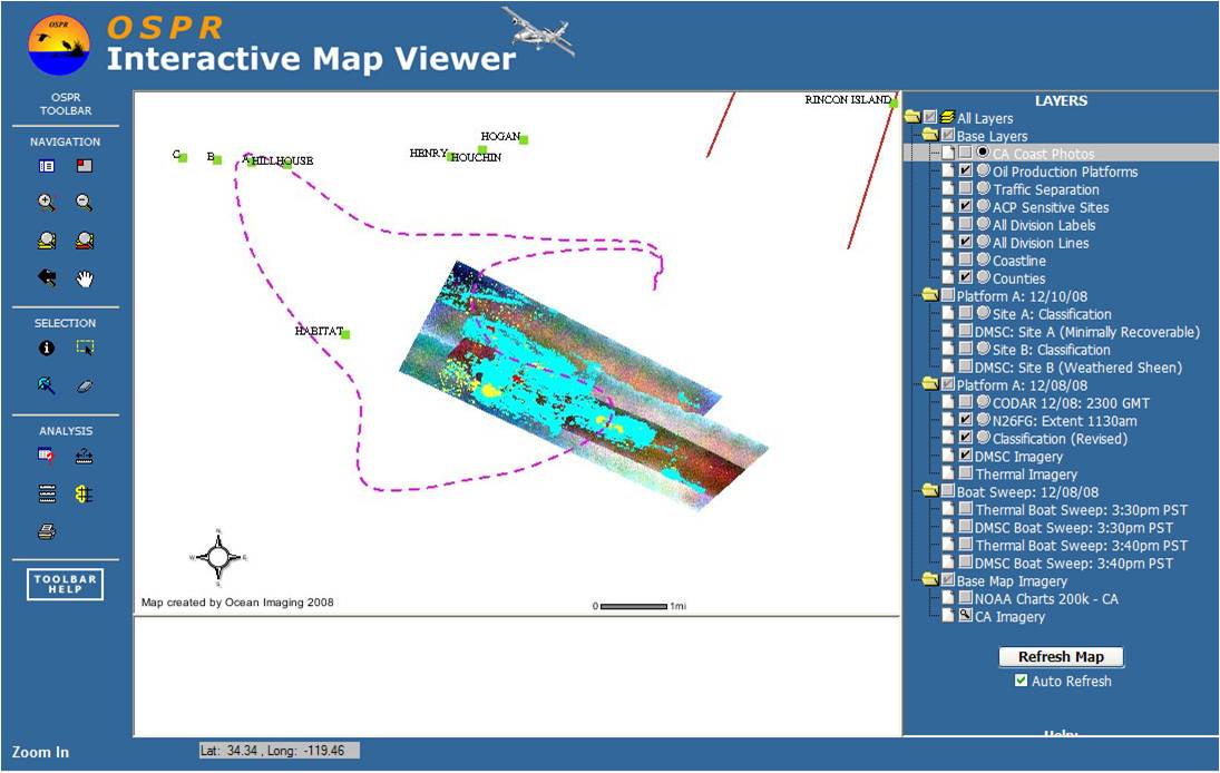
This screen shot shows oil spill thickness data and other data layers from a rapid response GIS system developed by Ocean Imaging for the State of California's Department of Fish & Game Oil-Spill Response Division (OSPR).