
Ocean Imaging News/Publications
Ocean Imaging News
2025
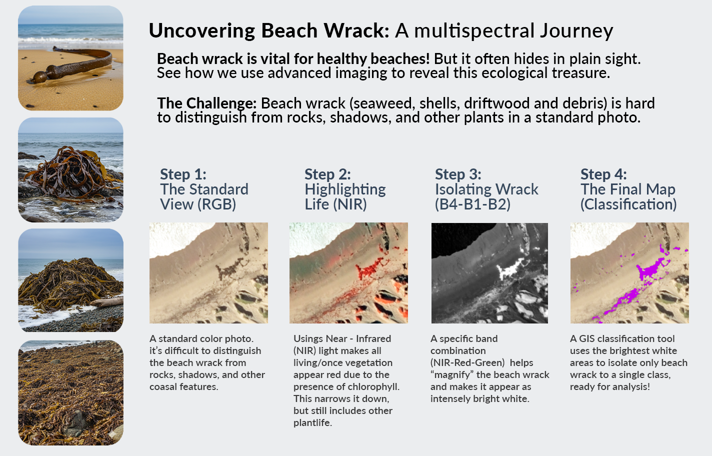
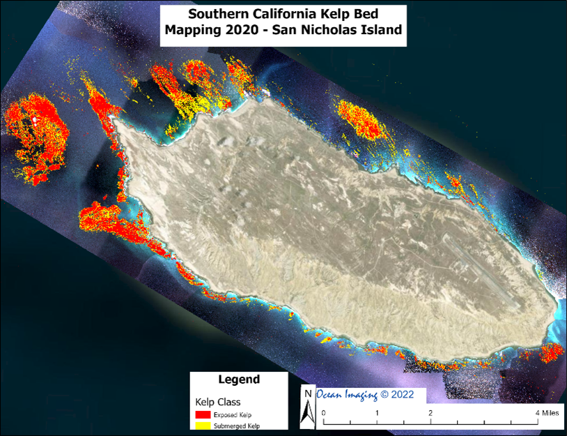
Ocean Imaging has been mapping Giant Kelp surrounding San Nicolas Island off the coast of California for over 15 years. Last year we began a multi-year project to not only map kelp, but also the beach wrack covering the island’s sandy beaches and rocky shoreline. What is beach wrack, you ask? Wrack can come in many forms from Giant Kelp and other seaweeds such as sargassum that washes ashore, to most any type of organic material that finds its way onto beaches. While sometimes seen as unsightly and you might avoid it when strolling along the sand, wrack is a critical part of the coastal ecosystem and provides a variety of essential ecological services.
For example, Beach wrack is a primary source of nutrients for the beach ecosystem. When it decomposes, it releases nutrients that are used by both terrestrial and marine organisms. It forms the base of the food chain by providing food and shelter for a variety of invertebrates like beach hoppers, kelp flies, and beetles. These small creatures, in turn, become a vital food source for shorebirds, migratory birds, and even some land animals. Wrack also provides nesting habitat for some birds and a safe place for sea turtle hatchlings to take cover as they make their way to the ocean.
Beach wrack essentially provides the ecological link between land and sea. It acts as a bridge, transferring nutrients and energy from the marine environment to the terrestrial environment. Since the sandy beach itself has little to no primary production, it is highly dependent on this imported material to support its unique ecosystem. This constant flux of organic matter ensures the health and biodiversity of both the beach and nearshore environments.
In addition, beach wrack plays a critical role in coastal geomorphology. It acts as a natural barrier that helps to reduce wave energy and protect the shoreline from erosion. The organic material and its associated fauna can trap windblown sand, which over time contributes to the formation and stabilization of coastal dunes. These dunes are essential for protecting coastal properties from storm surges and rising sea levels.
This is why it is important to keep tabs on this constantly changing mini ecosystem, which Ocean Imaging is proud to be a part of! So, the next time you are walking on the beach, maybe take a closer look at the organic debris piled on the sand. We are!
Ocean Imaging maps drinking water availability of federally endangered Florida Key Deer
.jpg) In 2016 Jan Svejkovsky, founder and President of Ocean Imaging, relocated with his wife from San Diego to the Florida Keys. Lifelong wildlife enthusiasts and long-time wildlife rehabbers in California, they founded “Save Our Key Deer” (SOKD – www.saveourkeydeer.org ), a non-profit 501-C corporation advocating for the endangered Florida Key Deer that survive only on a portion of the Keys. One of SOKD’s multiple activities is scientific research, financed by the group. Following the devastating Hurricane Irma in 2017, Svejkovsky utilized OI technical staff’s expertise to quantify vegetation damage in the Key Deer habitat and subsequent recovery rates using high resolution satellite imagery. The study was published in the journal “Estuaries and Coasts”.
In 2016 Jan Svejkovsky, founder and President of Ocean Imaging, relocated with his wife from San Diego to the Florida Keys. Lifelong wildlife enthusiasts and long-time wildlife rehabbers in California, they founded “Save Our Key Deer” (SOKD – www.saveourkeydeer.org ), a non-profit 501-C corporation advocating for the endangered Florida Key Deer that survive only on a portion of the Keys. One of SOKD’s multiple activities is scientific research, financed by the group. Following the devastating Hurricane Irma in 2017, Svejkovsky utilized OI technical staff’s expertise to quantify vegetation damage in the Key Deer habitat and subsequent recovery rates using high resolution satellite imagery. The study was published in the journal “Estuaries and Coasts”.
More recently, Svejkovsky and OI processed and published results of a multi-year field study done with the aid of SOKD volunteers monitoring the seasonal availability of natural and anthropogenic drinking water sources available to the deer. The results revealed that in many parts of their still existing habitat the Key Deer are now fully dependant on human sources of drinking water, a situation only expected to worsen with increasing sea level rise and climate change. This has major implications for future management and the deer’s survival. The study was published in the “Journal for Nature Conservation” and the paper is available by clicking on the above image.
2024:
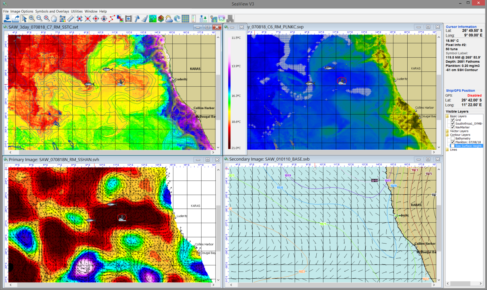
 Ocean Imaging & SeaView Fishing Celebrate 40 Years of Providing Satellite-Derived Ocean Analyses for Fisheries Support
July 2023:
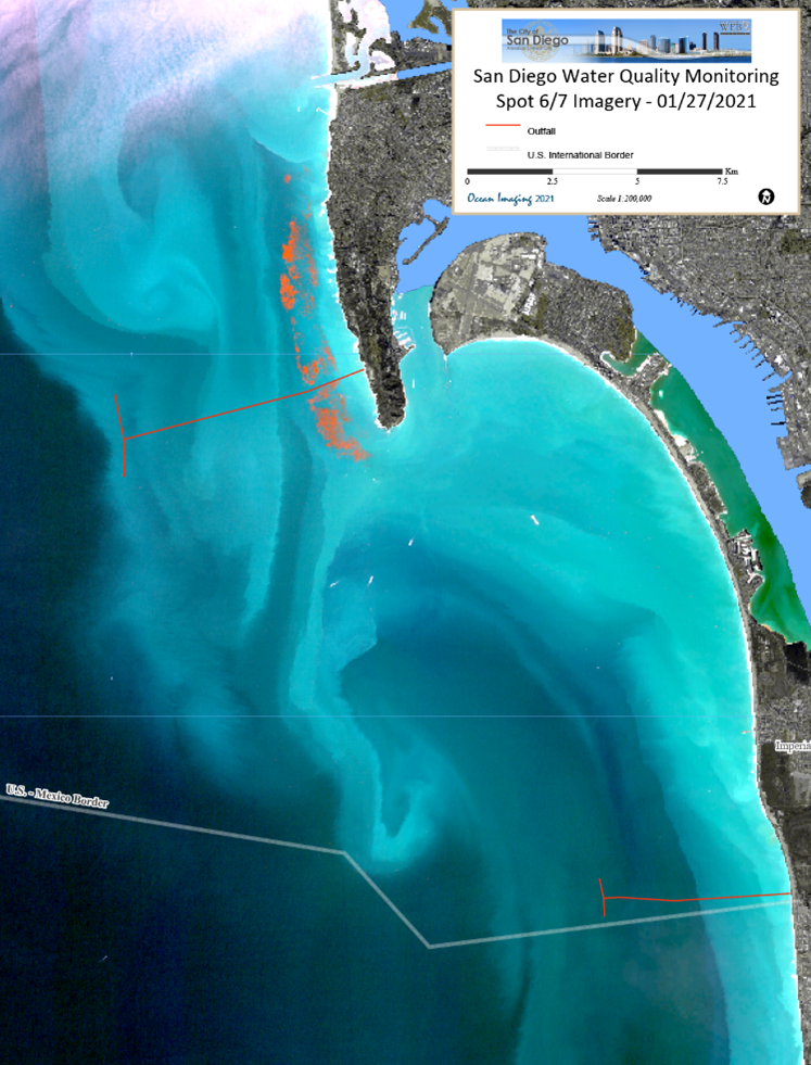 Ocean Imaging Renews Long-Term Contract with the City of San Diego to Help Monitor Coastal Water Quality
2022-2023:
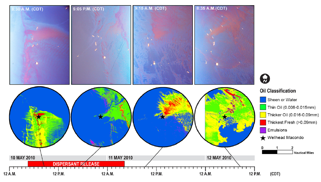 Ocean Imaging's latest peer-reviewed scientific paper on the use of remote sensing to study the effects of sub-sea dispersants during the Deepwater Horizon oil spill
2022-2023:
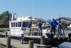
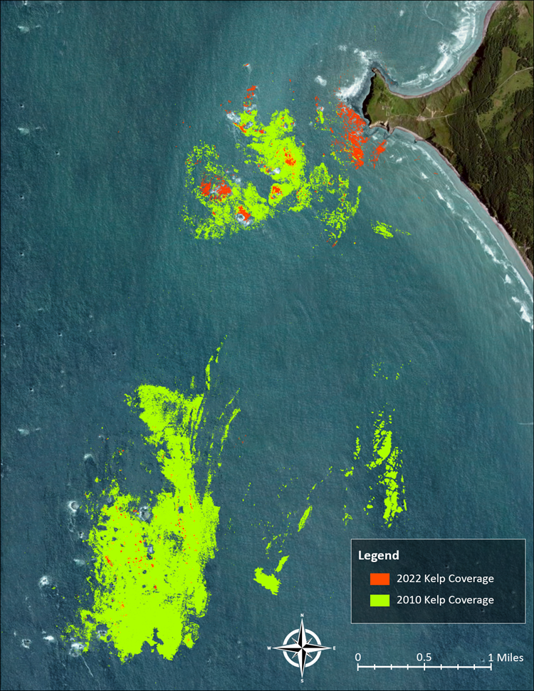 Ocean Imaging Works with Oregon Department of Fish and Wildlife to Map Coastal Kelp Beds
March 2023:
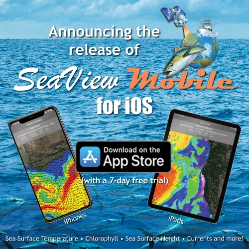 SeaView Fishing Mobile app now available for Apple Mobile Devices
NOVEMBER 2021:
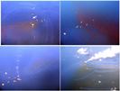
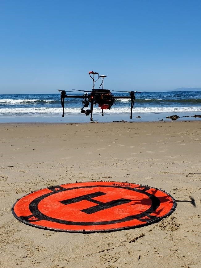 Ocean Imaging completes study to improve oil detection capability using a portable, UAS-Based SCAT Reconnaissance System
october 2021:
 Ocean Imaging rolls out SeaView Mobile app
JUNE 2021:
 Ocean Imaging completes latest round of projects to Map Kelp off the California coast
JUNE 2020:
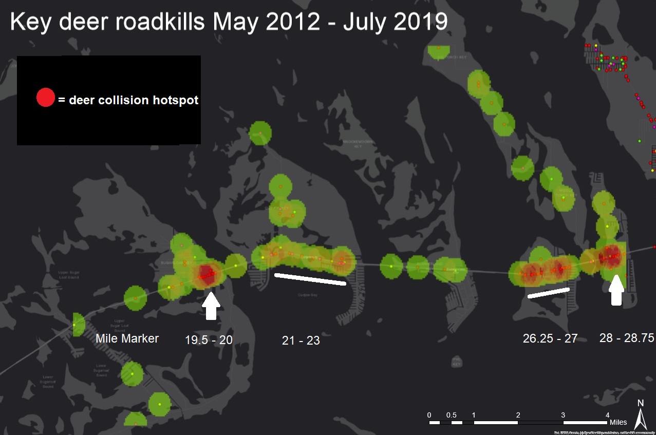 Ocean Imaging conducts GIS study of vehicle-caused Key deer deaths in the Florida Keys
January 2020:
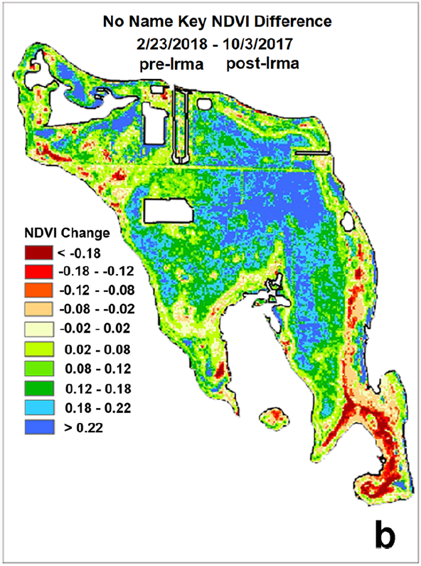 Ocean Imaging publishes peer-reviewed results of post-hurricane Irma study in the Florida Keys
January 2019:
 Ocean Imaging Receives Funding to Improve Oil Detection Capability Using a Portable, UAS-Based SCAT Reconnaissance System
December 2018:
 Ocean Imaging Celebrates 35 Years of "Finding Fish from Space"
December 2018:
 Ocean Imaging Marks 15 Years of an Environmental Monitoring Project to Help Restore California's Wetlands
27 November 2018:
 Ocean Imaging Completes Study of Vegetation Response to Hurricane Irma in the Florida Keys
April 2018:
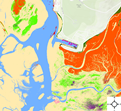 Ocean Imaging Continues 15 Years of Work to Map Eel Grass in Morro Bay, California
25 April 2017:
 OI and MSRC Partner to Equip All TRACS Aircraft with State-of-the-Art Air-to-Ground Data Transfer Systems
2016-2017:
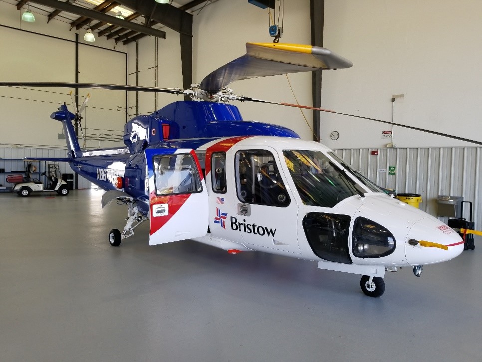 OI and MSRC Adapt OI's TRACS for Deployment on Helicopters
4 November 2016:
 Ocean Imaging's lastest peer-reviewed scientific paper on the characterization of oil spills during the Deep Water Horizon Oil Spill
22 JUly 2016:
 NOAA Partners with OI to Advance Oil Spill Remote Sensing