
Select Publications
“Expanding the Utility of Remote Sensing Data for Oil Spill Response”, PE&RS, October 2012.
OI News Items
2025:
.jpg) Ocean Imaging's latest peer-reviewed scientific paper on the existing unavailability of natural drinking water sites as a prime factor driving the domestication of Key deer.
Ocean Imaging's latest peer-reviewed scientific paper on the existing unavailability of natural drinking water sites as a prime factor driving the domestication of Key deer.
2024:
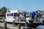
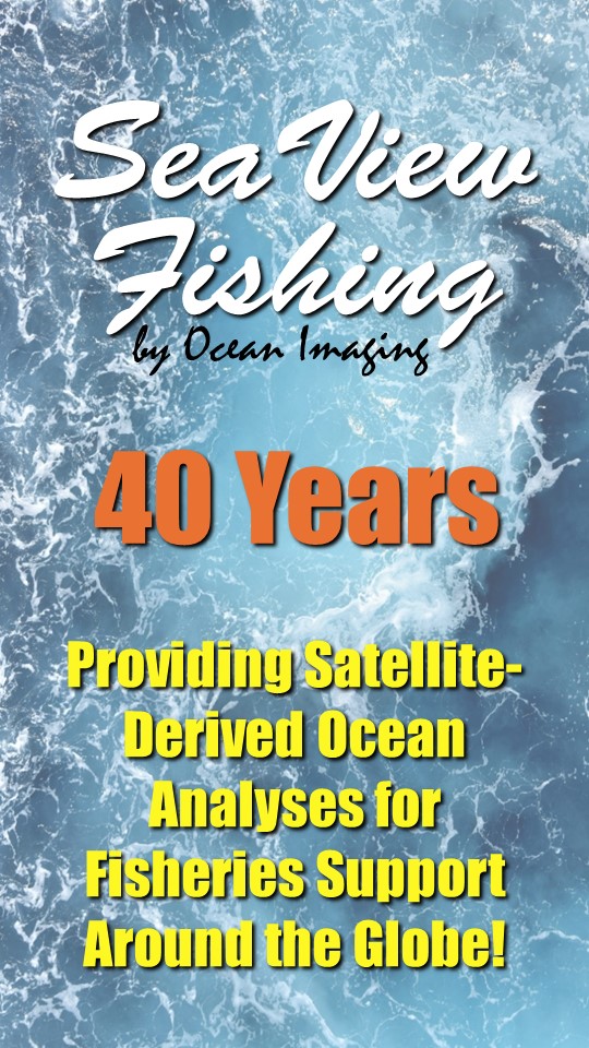 Ocean Imaging & SeaView Fishing Celebrate 40 Years of Providing Satellite-Derived Ocean Analyses for Fisheries Support
July 2023:
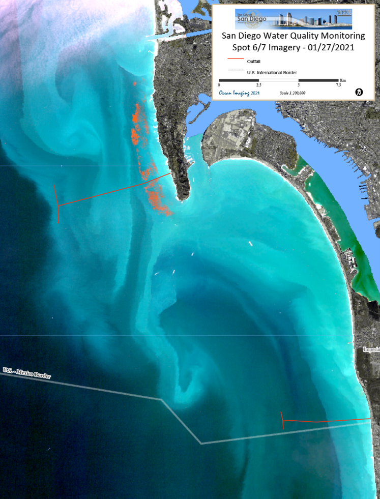 Ocean Imaging Renews Long-Term Contract with the City of San Diego to Help Monitor Coastal Water Quality
2022-2023:
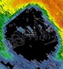
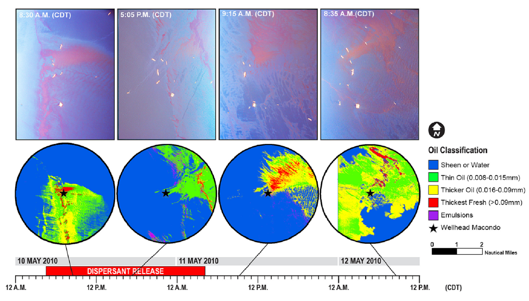 Ocean Imaging's latest peer-reviewed scientific paper on the use of remote sensing to study the effects of sub-sea dispersants during the Deepwater Horizon oil spill
2022-2023:
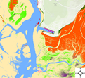
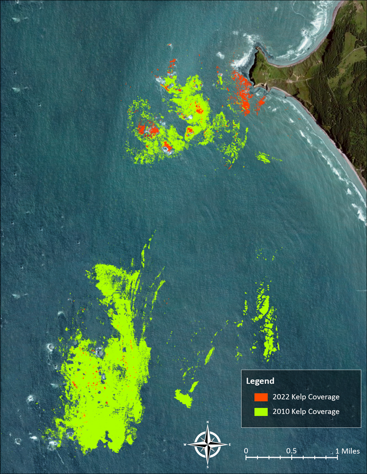 Ocean Imaging Works with Oregon Department of Fish and Wildlife to Map Coastal Kelp Beds
March 2023:
 SeaView Fishing Mobile app now available for Apple Mobile Devices
NOVEMBER 2021:
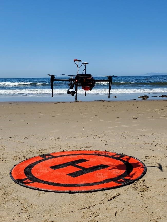 Ocean Imaging completes study to improve oil detection capability using a portable, UAS-Based SCAT Reconnaissance System
october 2021:
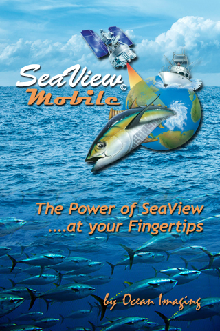 Ocean Imaging rolls out SeaView Mobile app
JUNE 2021:
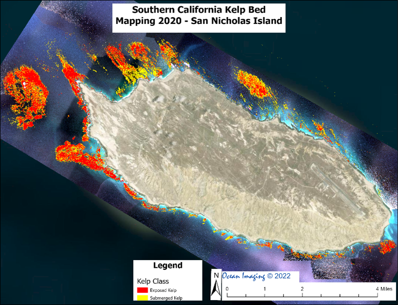 Ocean Imaging completes latest round of projects to Map Kelp off the California coast
JUNE 2020:
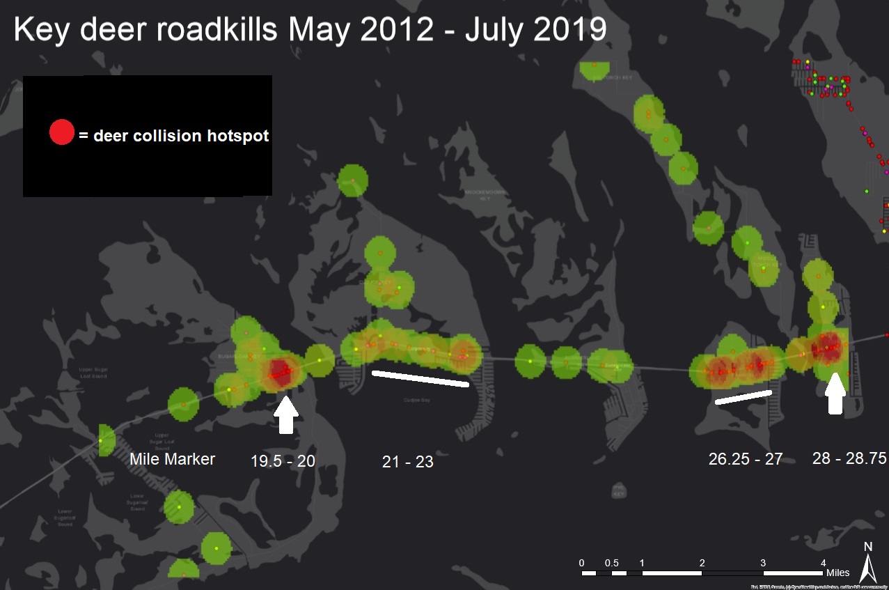 Ocean Imaging conducts GIS study of vehicle-caused Key deer deaths in the Florida Keys
January 2020:
 Ocean Imaging publishes peer-reviewed results of post-hurricane Irma study in the Florida Keys
January 2019:
 Ocean Imaging Receives Funding to Improve Oil Detection Capability Using a Portable, UAS-Based SCAT Reconnaissance System
December 2018:
 Ocean Imaging Celebrates 35 Years of "Finding Fish from Space"

December 2018:
 Ocean Imaging Marks 15 Years of an Environmental Monitoring Project to Help Restore California's Wetlands
27 November 2018:
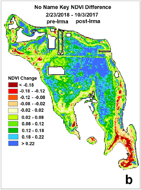
 Ocean Imaging Completes Study of Vegetation Response to Hurricane Irma in the Florida Keys
April 2018:
 Ocean Imaging Continues 15 Years of Work to Map Eel Grass in Morro Bay, California
25 April 2017:
 OI and MSRC Partner to Equip All TRACS Aircraft with State-of-the-Art Air-to-Ground Data Transfer Systems
2016-2017:
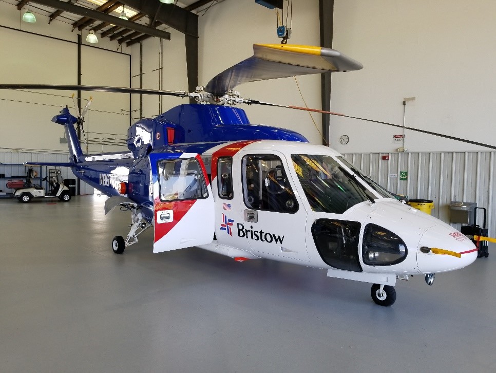 OI and MSRC Adapt OI's TRACS for Deployment on Helicopters
22 July 2016:
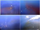 Ocean Imaging's lastest peer-reviewed scientific paper on the characterization of oil spills during the Deep Water Horizon Oil Spill
News/Publications/archives →