
PROJECT: |
Oil Spill Response - Classification Example |
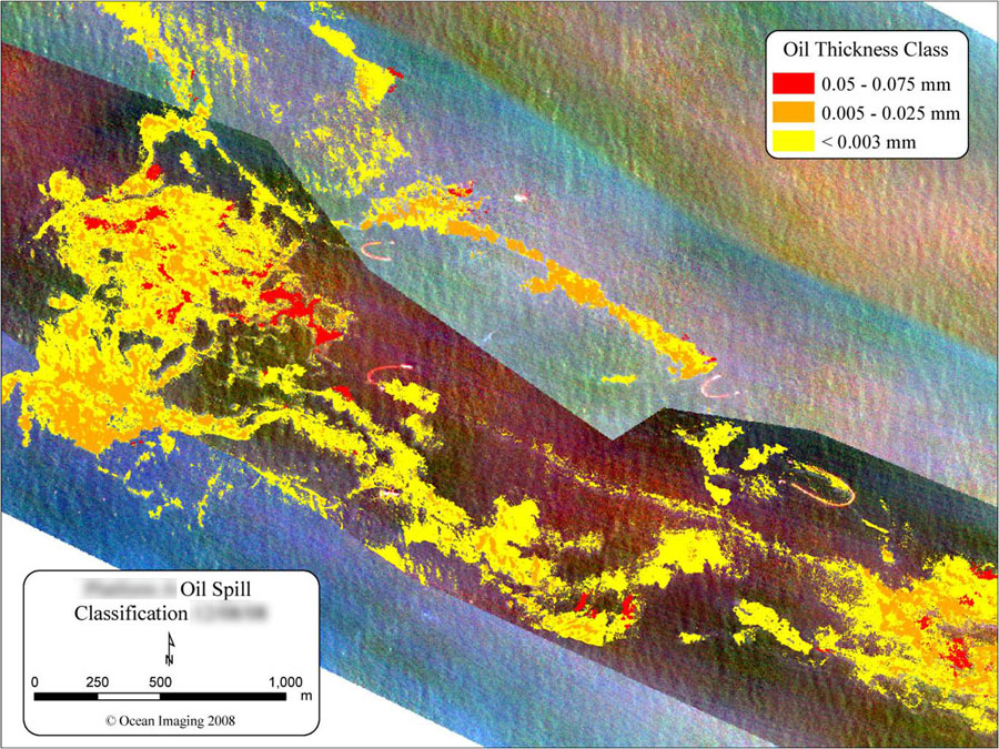
The multispectral/thermal aerial oil mapping system developed by Ocean Imaging was used operationally to map oil distribution and thickness on several spills in California since 2007.