
PROJECT: |
Intertidal Substrate Mapping |
LOCATION: |
Santa Barbara Island, CA |
DATE: |
2002 |
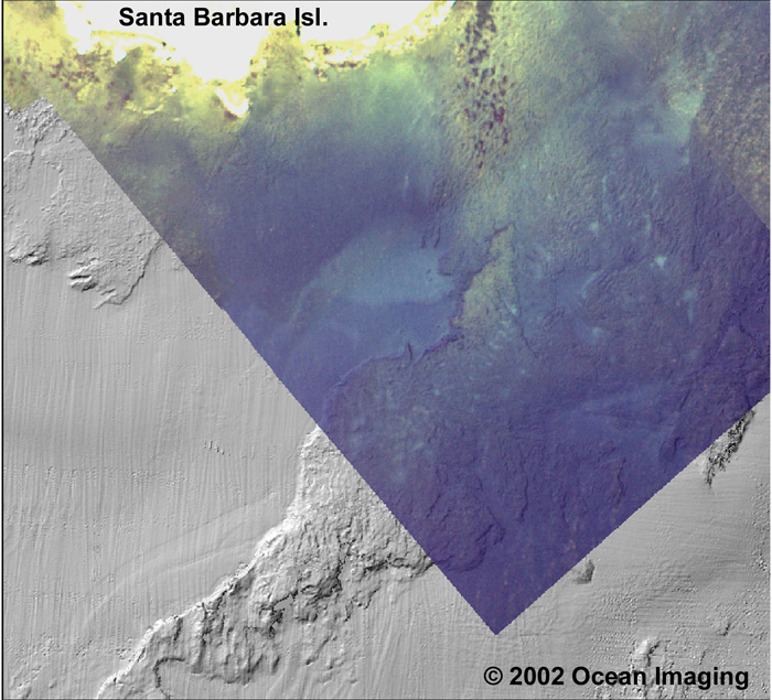
This image shows the merging of a sonar-derived bathymetry data base with multispectral aerial imagery. The resulting product provides information on both depth and bottom substrate.